The Rideau Canal is both a UNESCO World Heritage Site and National Historical Site.
The Rideau Canal stretches from Lake Ontario in Kingston to the Ottawa River following the Cataraqui and Rideau Rivers. It is 202 kilometers long, of which about 19 kilometers is man-made (locks and canal cuts), the rest are natural waters. There are 45 locks with 23 lock stations along the main route of the Rideau, and six lock stations can be founded within the township.
The canal winds its way through historic sites, charming villages, quaint attractions and spectacular recreation areas, offering visitors a variety of world-class arts, heritage, and recreation experiences.
The Rideau Canal makes up part of the northern border for the Township of Rideau Lakes.
Lock Stations
The Township of Rideau Lakes boasts six lock stations on the Rideau Canal. The locks on the Rideau operate today much as they did when first opened in 1832. The large wooden lock doors are opened and closed using hand cranks. Hand cranks are also used to let water in and out of the locks. Most of the stone blocks that you see are the ones originally emplaced in the 19th century.
Jones Falls
One of the prettiest lockstations on the Rideau, Jones Falls is home to the “Great Stone Arch Dam.” When completed in 1831, this was the highest dam in North America (almost 60 feet), a stunning feat of engineering, still very impressive to this day. The defensible lockmaster’s house, known as Sweeney House after the first lockmaster, Peter Sweeney, is open for interpretation. The blacksmith’s shop, built in the 1840s, often has a blacksmith on duty, more than willing to explain his craft.
Davis
Davis is known as a “solitude lock,” one of the most remote locks on the Rideau. It’s named after Walter Davis Jr. who built a sawmill here in about 1818. It features the best preserved example of a defensible lockmaster’s house on the Rideau. Built in 1842, this stone house served as home to the local lockmaster until 1959. The building was fully restored in 1999. The view, from this house into Sand Lake is, except for the navigation buoys, essentially what Colonel By would have seen when the canal opened in 1832.
Chaffeys
A feature of this lock is the Lockmaster’s house museum with many interpretive displays of the early days at Chaffeys. It’s also worth a walk around “town” – visit the grounds of the lovely old Opinicon Resort Hotel and then head over to the restored Chaffey’s Cemetery. The Cataraqui Trail, an all-season trail, part of the Trans-Canada trail system, passes through Chaffeys, following the old railway bed. The name of the lock comes from Samuel Chaffey, who set up extensive milling facilities here in 1820. He died in 1827 and Colonel By bought the property from his widow in order to build the lock. She got £2,000, worth in excess of $5,000,000 today.
Newboro
This spot, originally called the Isthmus, marks the watershed divide between the Rideau River watershed and the Cataraqui/Gananoque rivers watersheds. The original plan was to build two locks at Chaffeys and simply have a canal cut through this neck of land, creating a huge summit reservoir (from Chaffeys to Poonamalie). But flooding concerns meant a change of plans, one of the Chaffey’s locks was moved to Newboro. When hard bedrock was unexpectedly encountered, a third lock had to be built at the Narrows. Newboro was converted to electric/hydraulic operation in 1966-67, the first of only two locks (the other being Black Rapids) to be changed from manual to electric operation. The Old Presbyterian Cemetery was used to bury those who died during canal construction at this site, including about half of the 22 Sappers and Miners that died during the construction of the canal. The original wooden grave markers have long since rotted away, leaving just a few field stones marking the graves. Newboro also features one of the four blockhouses built for the defence of the Rideau Canal.
Narrows
The question you have to ask here is why is there a lock in the middle of a lake? It has to do with bedrock and malaria. When trying to excavate the canal cut through “The Isthmus,” the watershed divide at Newboro, hard bedrock was encountered. Seasonal malaria also impeded the work. To speed up construction and reduce the amount of excavation at Newboro, Lt. Colonel By came up with a plan to build a dam and lock here, at a natural narrowing of the lake. This raised the level of the portion of Rideau Lake on the west side of the Narrows, “creating” Upper Rideau Lake. One of the four blockhouses built on the Rideau is located here, to protect this important lock. Murphy's Point Provincial Park, located at the northern end of Big Rideau Lake (west shore) makes an interesting stop.
Poonamalie
This odd name dates back to the time of canal construction. The cool cedars in this area reminded one of the British soldiers of a previous posting in Poonamallee, India, a garrison town used by the British army. It was also known as First Rapids, being the first set of rapids on the Rideau River. Have a look at the beautiful lockmaster’s house, still home to today’s Lockmaster, one of only three still in use by lockmasters on the Rideau. Take a hike to the dam and weir, a 1km trail leads to the upstream control dam - very scenic. The dense cedars provide cool shade and an enchanting scent. The location of the dam, at the bottom end of Lower Rideau Lake, is susceptible to spring ice damage. In April 1904, a 300 foot (91 m) wide sheet of ice opened up a 75 foot (23 m) hole in the weir. The dam and weir were then re-done in concrete. In 1971 the dam was again rebuilt, this time a large hydraulic gate replaced the wooden stop logs previously in use.
Your Adventure Awaits
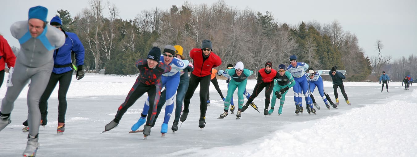
There is just so much of interest along the Rideau that it is hard to know where to start, in Canada's shining jewel. The Rideau Canal offers attractions such as fishing, wildlife, parks & beaches, hiking, cycling, paddling, group tours, shopping, museums, dining, interesting communities, marinas, golfing, skating, skiing, snowmobiling and more.


