Discover (146)
Children categories

Villages (8)
Our Villages and Hamlets
Rideau Lakes is a community of Villages and Hamlets. Explore and learn about the landscape and the people. Each village and hamlet have a unique culture and story to tell. Whether you’re a visitor looking to discover your roots in the area, a family trying out an adventure on the water, or an urbanite seeking a safe and quiet, rural lifestyle… Rideau Lakes will find a place in your heart.
For thousands of years before European settlers arrived in what is now called Rideau Lakes, Algonquin speaking peoples, the Massasauga and proto-Hurons lived in these lands. Indigenous artifacts have been discovered around all of the lakes throughout this area, some that are more than 9000 years old. When the European settlers arrived, just over 200 years ago, the communities of Rideau Lakes were born.
The Rideau Canal is both a UNESCO World Heritage Site and National Historical Site.
The Rideau Canal stretches from Lake Ontario in Kingston to the Ottawa River following the Cataraqui and Rideau Rivers. It is 202 kilometers long, of which about 19 kilometers is man-made (locks and canal cuts), the rest are natural waters. There are 45 locks with 23 lock stations along the main route of the Rideau, and six lock stations can be founded within the township.
The canal winds its way through historic sites, charming villages, quaint attractions and spectacular recreation areas, offering visitors a variety of world-class arts, heritage, and recreation experiences.
The Rideau Canal makes up part of the northern border for the Township of Rideau Lakes.
Lock Stations
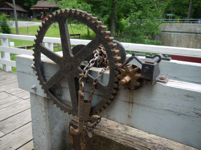
The Township of Rideau Lakes boasts six lock stations on the Rideau Canal. The locks on the Rideau operate today much as they did when first opened in 1832. The large wooden lock doors are opened and closed using hand cranks. Hand cranks are also used to let water in and out of the locks. Most of the stone blocks that you see are the ones originally emplaced in the 19th century.
Jones Falls
One of the prettiest lockstations on the Rideau, Jones Falls is home to the “Great Stone Arch Dam.” When completed in 1831, this was the highest dam in North America (almost 60 feet), a stunning feat of engineering, still very impressive to this day. The defensible lockmaster’s house, known as Sweeney House after the first lockmaster, Peter Sweeney, is open for interpretation. The blacksmith’s shop, built in the 1840s, often has a blacksmith on duty, more than willing to explain his craft.
Davis
Davis is known as a “solitude lock,” one of the most remote locks on the Rideau. It’s named after Walter Davis Jr. who built a sawmill here in about 1818. It features the best preserved example of a defensible lockmaster’s house on the Rideau. Built in 1842, this stone house served as home to the local lockmaster until 1959. The building was fully restored in 1999. The view, from this house into Sand Lake is, except for the navigation buoys, essentially what Colonel By would have seen when the canal opened in 1832.
Chaffeys
A feature of this lock is the Lockmaster’s house museum with many interpretive displays of the early days at Chaffeys. It’s also worth a walk around “town” – visit the grounds of the lovely old Opinicon Resort Hotel and then head over to the restored Chaffey’s Cemetery. The Cataraqui Trail, an all-season trail, part of the Trans-Canada trail system, passes through Chaffeys, following the old railway bed. The name of the lock comes from Samuel Chaffey, who set up extensive milling facilities here in 1820. He died in 1827 and Colonel By bought the property from his widow in order to build the lock. She got £2,000, worth in excess of $5,000,000 today.
Newboro
This spot, originally called the Isthmus, marks the watershed divide between the Rideau River watershed and the Cataraqui/Gananoque rivers watersheds. The original plan was to build two locks at Chaffeys and simply have a canal cut through this neck of land, creating a huge summit reservoir (from Chaffeys to Poonamalie). But flooding concerns meant a change of plans, one of the Chaffey’s locks was moved to Newboro. When hard bedrock was unexpectedly encountered, a third lock had to be built at the Narrows. Newboro was converted to electric/hydraulic operation in 1966-67, the first of only two locks (the other being Black Rapids) to be changed from manual to electric operation. The Old Presbyterian Cemetery was used to bury those who died during canal construction at this site, including about half of the 22 Sappers and Miners that died during the construction of the canal. The original wooden grave markers have long since rotted away, leaving just a few field stones marking the graves. Newboro also features one of the four blockhouses built for the defence of the Rideau Canal.
Narrows
The question you have to ask here is why is there a lock in the middle of a lake? It has to do with bedrock and malaria. When trying to excavate the canal cut through “The Isthmus,” the watershed divide at Newboro, hard bedrock was encountered. Seasonal malaria also impeded the work. To speed up construction and reduce the amount of excavation at Newboro, Lt. Colonel By came up with a plan to build a dam and lock here, at a natural narrowing of the lake. This raised the level of the portion of Rideau Lake on the west side of the Narrows, “creating” Upper Rideau Lake. One of the four blockhouses built on the Rideau is located here, to protect this important lock. Murphy's Point Provincial Park, located at the northern end of Big Rideau Lake (west shore) makes an interesting stop.
Poonamalie
This odd name dates back to the time of canal construction. The cool cedars in this area reminded one of the British soldiers of a previous posting in Poonamallee, India, a garrison town used by the British army. It was also known as First Rapids, being the first set of rapids on the Rideau River. Have a look at the beautiful lockmaster’s house, still home to today’s Lockmaster, one of only three still in use by lockmasters on the Rideau. Take a hike to the dam and weir, a 1km trail leads to the upstream control dam - very scenic. The dense cedars provide cool shade and an enchanting scent. The location of the dam, at the bottom end of Lower Rideau Lake, is susceptible to spring ice damage. In April 1904, a 300 foot (91 m) wide sheet of ice opened up a 75 foot (23 m) hole in the weir. The dam and weir were then re-done in concrete. In 1971 the dam was again rebuilt, this time a large hydraulic gate replaced the wooden stop logs previously in use.
Your Adventure Awaits
There is just so much of interest along the Rideau that it is hard to know where to start, in Canada's shining jewel. The Rideau Canal offers attractions such as fishing, wildlife, parks & beaches, hiking, cycling, paddling, group tours, shopping, museums, dining, interesting communities, marinas, golfing, skating, skiing, snowmobiling and more.
Undoubtedly First Canadians frequented the blue water, the shores and portages of Rideau Lake for millennia and it would seem that early European homesteaders were raising their cabins and crops in the vicinity of Portland in the 1790's. It is recorded that a saddlebag man of the cloth was arrested as a vagabond for visitations and sacraments that the authorities considered prolonged.
The original land grant for the site of Portland is dated 1801. But a community was not born until 1816 when "The Landing" became the major stepping-off point for those intending to homestead in the Perth area. Settlers, the eager, the anxious, arrived from Brockville by bush trail to The Landing, by barge down Rideau Lake and up the Tay Valley to Perth. The completion of the Rideau Canal in 1832 opened the Rideau countryside and "Old Landing" to the world. With the establishment of a post office in 1842, Portland received its official name. Commercial traffic on the Rideau and the growth of agriculture across the hinterland nurtured numerous businesses catering to the needs of farm families and the export of raw materials. Steamers and barges departed from Portland laden with barrels of potash and cords of wood from the clearing of forest, bales of tanned hides and casks of salt beef from the bounty of field. Hence Portland became a thriving village of trade and transhipment. But by 1900, the nature of commercial activity was changing. Advances in rail and road travel and the advent of tourism offset a gradual decline in the role of agriculture. Portland remains today with much of its economic and cultural life focused on Big Rideau Lake. The Municipal Heritage Advisory Committee endeavours with this Walking Tour to illustrate a variety of architectural influences reflected in the buildings of Portland. Amble casually with us. Imagine the welcome clang of steam boat bell, the aromas of outer-world spices and local cheddar in grocer shops, the humming of mills, business being done, the laughter and tears of family and village life as it was ten and fifteen decades ago.
Additional Info
- Length Approx. 1.5km
-
Houses

-
Map

A Brief History
For millennia, hunters and fishers traversed the height-of-land between the Rideau and Mud (Newboro) Lakes. European explorers, missionaries, traders and pioneers followed. But without falling water for power, rumor and record has it that by the year 1820 only a few settlers had cleared forest and cropped land on this “band of bush” that divided the Rideau from the Cataraqui Basin. But that all changed. During the years 1826-32, the Rideau Canal was built under the direction of Lieutenant Colonel John By and the Royal Engineers as part of British defense strategy in North America. This canal linked the navigable waters of the Rideau River System flowing northward to Bytown (now Ottawa) and the Cataraqui System flowing southward toward Kingston. Excavating this connective channel at the isthmus was one of the most difficult tasks undertaken. It demanded digging and blasting through a hard ridge of Canadian Shield granite lurking in the landscape. Many lives were lost to accidents and swamp fever (malaria). Private contractors went bankrupt. Ultimately the 7th Company of Royal Sappers and Miners completed this vital link between 1829 and 1832.
In time, the construction community called “The Isthmus” faded away and a new community located on the east side of the channel took form. This place of people and commerce was formally named New Borough, then Newboro.
Throughout the 19th century, Newboro grew and prospered at the keystone of the Rideau arch. Built to defend British North America from American invasion, the Rideau Canal transported vast amounts of produce from forest and farm to the United States, especially to the North during the Civil War. In the latter part of the 19th century, steam tugs towed barge loads of iron ore from local mines to smelters south of the border. Cotton bag miners bartered their books of mica to General Electric.
Newboro developed as a thriving community. The bridge spanning the Rideau Canal became a busy link in the “Stone Road” to Westport. “Main Street” still hints of an era of travel and commerce, lodgings and shops, a bustling streetscape that paralleled the Canal. Warehouses and wharves, some owned by the renowned Tett family skirted the canal. A blast of the steam boat whistle announced the arrival of the Rideau King or Rideau Queen; travelers from far-off Smiths Falls and beyond; voyagers to far-off Kingston and beyond. You can still find a cleat anchored in stone along the canal where barges tied up to load and unload their cargoes.
In 1888, the Brockville - Westport & Sault Ste. Marie Railway added a new dimension of travel, even in winter. Produce of local farm, forest and fur trapping entered wider markets through Newboro’s cannery, mills and merchants. From Newboro Station, local scholars went to and from high school in Athens and Brockville.
Straddling the “town line” boundary between North and South Crosby and feeling economically and politically distinct from both Crosbys, Newboro declared its independence in 1876 and for many decades it bragged of being an “incorporated village”; one of the smallest incorporated communities in Ontario. Now, Newboro is a vital part of North Crosby Ward of our Township of Rideau Lakes.
Surrounded by lakes including the Upper Rideau and Newboro Lake, Newboro has become a popular vacation center. Annually people come to enjoy our scenery and the diverse array of activities the lake offers. The ambiance of our fine historic inns continue to attract people from afar. Welcome aboard.
Walking Tour
-
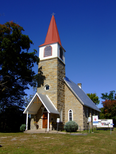
St. Mary’s Anglican Church, 1861
15 Brock Street

Anglicans first held their meetings in an “upper room” of Benjamin Tett’s home (built 1835). There at No.1 Main Street a saddlebag preacher, Rev. T. Tremayn, proclaimed the Will of God from 1839 to 1857. In due time, the devout congregation of St. Mary’s built their permanent house of worship. Benjamin J. Tett purchased the land and paid the wages of the workmen who built this church. When the last shingle was to be nailed to the roof, the carpenter called for John Poole Tett, Benjamin’s son, to swing the hammer. Thus, two generations of the Tett family worked on their church.
Built in simple Gothic Revival style, this church has high walls and a belfry with a short spire on a square tower. Beautiful stained glass adorns its windows; one of exquisite Tiffany. Inside, there is an elegant altar with a communion rail enclosing two sides. At the left front is a “rostrum pulpit” and on the right front are the organ and choir stalls. There is still evidence of the “Boxed Pews”. Exquisite woodwork attests to the dedicated craftsmanship of the builders and the devoted care of its loyal congregation over the past fifteen decades.
-
Court House, c 1840
10 Brock Street

Built in 1840, Newboro’s Court House retains its original exterior design. There was one addition, evidence of which can be seen along the west face. Once used as Town Hall, Court House and jail, the door to the cell was recently located and has been re-hung in the back room of the building. Interestingly Newboro employed an executioner for years, although it is unclear if his services were ever required.
Paddy O’Rourke was one of the first persons to be tried in Newborough’s new Court House. In November of 1842, Paddy was angry with the magistrate for fining him “seven & sixpence” for being intoxicated while trying to board a steamboat without fare. During the night, he stole what he thought was a keg of blasting powder from Tett’s warehouse and concealed it behind the courthouse. The next afternoon, Court was in session with the same despised magistrate presiding. Paddy, keg under arm and ambitions of Guy Fawkes in mind, looked around the courthouse for a basement door. Finding none (for there was no basement), he planned to set the keg against the end of the building, light the fuse and run. When he knocked the bung from the keg, he found its contents not to be blasting powder but rum. This was too good to pass up; so sitting beside it, Paddy commenced to drink the rum, the fuse still sticking out of the barrel. Needless to say, he was eventually found passed out, arrested, and tried for theft. For many years afterwards, the youth of Newboro made dummies to represent old Paddy. Each November 10th, they would wheel it through the streets shouting, “A penny for old Paddy please”. A popular rhyme of the day was:
“Please do recall,
The boozy downfall
Of Paddy O’ Rourke’s crazy plot.
We will remember
The 10th of November.
In Newboro, it won’t be forgot!”
Newboro Newsletter; Nov.13, 1911
Once used as a public school, separate entrances for boys and girls can still be seen on the front façade. One might surmise that some students found little distinction between the building’s role as a school and as a jail. This place of rhyme and reason is now our Library.
-
Richard Blake House, c 1858
14 Main Street

The Blake House is just one of several fine examples of “Ontario Cottages” in Newboro. The Ontario Cottage is typical of many homes of the mid-1800’s; one- and-one-half stories in height and built by frugal owners. Tax laws from between 1807 and 1853 assessed houses as either one full storey or two full stories. A gable window over the front doorway provided light to a central hallway on the upper floor. Window designs could be pointed Gothic, square-headed Tudor, round-headed, (usually shuttered), circular or large three sectional. The decorative bargeboard, often called gingerbread was usually added in the mid 1850’s when more delicate woodworking tools became available to local tradesmen. The verandah became an important feature of Ontario Cottages, generally being added in the latter half of the 19th century.
-
“Dominion House” Hotel, c 1865
15 Main Street

Thomas Kenny and his son, James, constructed this fine building along Main Street on property purchased from Benjamin Tett. Originally an inn on this busy thoroughfare, it is said that Sir John A. MacDonald stayed here overnight. George Bolton bought the building for his private residence in 1887 and it remained in the family until the 1990s. Harken to the echo of horse and harness enroute to where Main Street once turned and bridged the Rideau Canal. Imagine the whistle of the B. & W. arriving on the nearby railway track. Imagine the smell of wood-fired steamers on the Canal and the aroma of apples being processed in the cannery at the end of Main Street.
A century-and-a-half after construction, the “Dominion House” still contains an interesting and authentic example of a semi-elliptical or fan-tailed neo-classic (Loyalist) door. Such portals were popular in houses built during the latter half of the 19th century. But this Adamesque entrance is unique. Over one hundred similar designs have been recorded in the area but only four such doorways are identical.
-
R.O. Leggett House & Shop, c 1870
4 Main Street

Mr. R.O. Leggett, following his father Henry, owned a furniture and undertaking business here. This L-shaped structure is typical of late nineteenth century commercial-residential structures. Note the intricate treillage work on the veranda posts. As in most local villages during the 1800s, the trades of furniture making and funerary were closely allied; the materials, tools and skills for making fine tables and chairs were the same as the fashioning of fine coffins! Mr. Leggett also owned a livery from whence he provided the horse power to transport travelers from village to village and dearly departed from church to graveyard; a one-way trip, not to be rehearsed. For almost nine decades, the Leggett family served the Newboro community from this fine home and business on Main Street.
-
John Webster House, c 1860s
5 Main Street

William Bell had a house here that was destroyed by fire before 1860. Indeed, Newboro has lost many heritage structures to the ravages of flames. John Webster bought lots 3 and 4 and it is believed he built this elegant home and provided lodging to travelers. Built sometime around 1860, this frame house contains excellent examples of Classical Revival architecture. The entrance manifests a rectangular transom with sidelights, typical of Revival architecture. These doorways were useful as well as decorative for they let natural light into the central hallway during times before Edison’s light bulb. The bracketed shelf above the door was probably a later addition, as were the Doric columns flanking the sidelights. The central window is of unusual interest. Of casement variety with a fanlight transom above it, its style is completely unconformable with the rest of the house. In 1903 George Wrathall purchased the home and operated a jewelry business from it.
-
Col. John Kilborn Home
2 Drummond Street

This building of mixed styles is believed to be a combination of John Kilborn’s home and George W. Preston’s “Ottawa Hotel” which burned in 1903. The stone component of this building is believed to be material recovered from the Ottawa Hotel.
There is a simple frieze that runs under the overhanging eaves. The frame structure was Col. Kilborn’s home. In 1828 while living in Brockville, Col. Kilborn was elected to Parliament. When his term expired, he declined re- election and moved to Kilmarnock. In 1852, he was appointed postmaster of Brockville, from which he later resigned and ran unsuccessfully for Parliament against Mr. Benjamin Tett. He then retired to Newboro. Colonel Kilborn donated the site for the first Wesleyan Presbyterian Church on Drummond Street in 1850, and he and the five Chamberlain brothers had the church erected. Col. Kilborn and his wife Elizabeth Sherwood had nine children – eight sons and one daughter. This eminent citizen of Newboro died in his 94th year.
-
The Stagecoach Inn, c 1855
4 Drummond Street

James MacDonald, an early merchant in Newboro built this substantial home and business. In 1872, William O’Connor purchased the building and converted it to “The Ontario Hotel”. The Landons then became the owners, changing its name to “Landon House”(1920-1966). In 1966, it became “The Stagecoach Inn”.
Its original design is Georgian. Although the front door has been replaced, it is reminiscent of the original entrance. The transom and sidelights are original and most attractive. In the dining room of The Stagecoach is a large painting of “The Ontario Hotel”(1869-1920) as it once graced Newboro, and still does.
-
Block House, c 1832

The blockhouse was built in 1832-33 to defend this very strategic lock station. Located on this height-of-land and cleared of surrounding forest, it was designed to withstand attack by Americans from any direction. The lower section, approx. 6m x 6m consists of stone walls 1m thick. The top section is constructed of squared timbers (now clapboarded), dovetailed at the corners and with an overhang of 0.6m.
This blockhouse is one of only four that were ever completed. Legend has it that only once was its militia called out for action, not to fend off a raid by feared foreign raiders, but to quell a local riot at Bully’s Acre at the end of Main St.
Newboro Lock is one of 3 on the Rideau that was modernized with hydraulically-operated steel gates. Community action demanded the preservation of historic aspects of the Rideau Canal, and the other 40 locks of our UNESCO World Heritage Site continue in the original mechanical mode of 1832.
-
John Poole Tett House, c 1896
14 By Street

Here, Robert Leech’s furniture factory once hummed with activity. Robert was one of 10 Leech sons who later founded the town of Gorrie, Ontario. Later, James Leggett’s tannery was located here. By the late 1800s, change was coming to Newboro, from primary industry to business and to tourism. Reputedly completed in 1886, this majestic residence reflects styles of homes built in the early 1900s. In contrast, it has brick trim characteristic of an earlier period. Note its tall windows, bays, and striking chimneys. From its uniquely styled front dormer on the 3rd storey, John Poole Tett and his wife Effie (nee Gallagher) enjoyed the view across a waterway of commerce and a land of resources. “The Manor” guests of Stirling Lodge now enjoy a more relaxed view of water, forest, and nature reincarnate.
-
John Draffin House, c 1854
11 New Street

Walk around the bend of New Street where it joins Ledge Street and you will find the first stone home constructed in the village. At the rear of this residence is an original single storey stone house. Built with ashlars of massive sandstone, it later served as a back kitchen. A fire in 1895 demanded extensive renovations and a second floor was added.
Born in Ireland in 1811, John Draffin emigrated to the Canadas. Prospering as a merchant, he added this magnificent residence to the original farmhouse c1860. Elaborate detail of Italianate style on the main house includes wide, bracketed cornices and on the corners are larger ashlars of a pattern termed quoining. Decorative round-headed doors grace the upper storey. Once these opened onto a small balcony above a grand front porch. From this balcony, Mr. Draffin, wealthy citizen of Newboro and his wife, Margaret Bell of Perth, could enjoy a magnificent view over Newboro Lake at a time when intervening trees had been cleared. Between 1895 and 1945 this was the parsonage for St. Mary’s Church. (#1)
-
J.T. Gallagher House, c 1885
7 Drummond Street

The Gallagher house was constructed with detail of Gothic Revival style. It is an extraordinarily tall building, being some two-and-one-half stories. The 1st storey was constructed of 5 courses of brick; the 2nd, four courses; and the 3rd of three, with inner walls of lath and plaster. To offset this dramatic perception of height, a two-storey bay extends from the front wing. Extensive dripped bargeboard (a popular addition to Gothic Revival buildings) serves to lower the roofline. Locally quarried sandstone lintels break the vast brickwork. With stylized treillage, the verandah conceals the double door entrance. Also of interest is the distinctive ornate roofing of slate, a feature unique in the village. Local legend tells of a contest between J.T.Gallagher and John Poole Tett, who was building his home on By Street (# 10) at the same time. These two prominent citizens with family connections vied to see who could build the tallest house. Gallagher won when he extended the height of his chimneys by some 0.4m. His son-in-law, Dr. Robert B. King purchased the home in 1916 and lived here until his death in 1942.
-
Union Bank Building, 1905
24 Drummond Street

Like many structures in the area, this was built of local brick. Constructed in 1905 by John F. Graham to house the Union Bank, the building remained in the Graham family for over a century. This two-storey building provided banking hall and offices on the first floor. The interesting cornicing and the flat roof are characteristic of several contemporary banks erected in the area. Its massive front façade with large arched windows and door imposes a sense of assurance and security on those entering with surplus shekels to save or loans to seek. The living quarters of the manager and his family were on the second floor where he could stay “on top of the money”. By the early 1900s, Drummond Street had become the focus of commerce, road traffic and parallel to rail travel. For over a century this fine example of rural “bank architecture” served Newboro commerce and community.
Additional Info
- Length Approx. 3km
-
Houses

-
Map

Each community is unique in time and place. Among the people places in the Township of Rideau Lakes, Elgin is unique. Communities such as Delta and Lombardy were nurtured by falling water and rumbling mills. Portland and Newboro attracted early travellers with canoes and steamboats. But Elgin prospered without waterpower or waterside. Its pioneers of the early 1800’s found that nurtured by a benign mid-latitude climate there grew a luxurious mix of white pine and oak. This forest thrived on a deep sandy loam, almost boulder-free, gently sloping and easily drained, easily plowed and very fertile. This fl edgling community soon won the notice of the surveyors and builders of the Rideau Canal. By coincidence of geology, this pioneer site became the source for much of the sandstone used to construct the great dam at Jones Falls and the locks there and nearby. Bustling work camps presented an insatiable demand for local teamsters and teams, a lucrative market for food and fodder. Families with names like Delong and Halladay prospered. They came to this emerging centre of commerce to trade their barrels of potash and salt pork for tea and fi ne tea cups, to have their horses shod and harnesses stitched, boots cobbled and buckets smithed. Even after the completion of the Rideau Canal in 1832, the community that was to become Elgin persevered and prospered on its foundation of rich soil and strategic location. Elgin has persevered through economic depressions across country and continent. It has prospered through wars fought near and far, a Civil War to the south and two World Wars. It has seen the rise and the fall of a century of cheddar cheese industry. It now thrives as a commercial hub for citizens and tourists here at the Keystone of the Rideau Corridor, a UNESCO World Heritage Site, a National Geographic Destination.
The village developed on Lots 12 and 13 on Concession 2 of the Township of South Crosby (Hub of the Rideau, p.200). Those lots were granted in 1801 to Leeds County women, Susannah Wiltse and Rebecca Wing, both daughters of United Empire Loyalists. Neither took occupancy and both parcels were eventually purchased by Samuel Halladay. In 1818, Ebenezer Halladay bought a 100 acre portion of Lot 12, Concession 2 from his brother and settled on that portion which now forms the south-east quarter of Elgin bounded by Main and Kingston Streets. As a young boy Ebenezer had been blinded in one eye when he tried to undo a knotted shoelace with a fork. The utensil fl ew out of his hand and struck his eye. His handicap did not prevent him from enlisting in the 2nd Leeds Militia during the War of 1812, nor did it hinder his many farming, business and civic activities. Within a decade Eben had cleared 25 acres, built a log house and was becoming a prosperous farmer. After the death of his fi rst wife Jane Leggett, he married Parthena Olds and the couple raised a family of 11 children from his two marriages. Ebenezer and his sons Benjamin and Phillip played signifi cant roles in their hamlet, Halladay’s Corners. Along with selling lots along Main St., they donated land for the first two schools, the South Crosby Community Hall, the Evangelical Methodist Church and the Halladay Burial Ground.
Additional Info
- Length Approx. 1.5km
-
Houses

-
Map

Throughout the 1800s Chaffey’s witnessed a continuous flow of steamships and barges that carried colonist, wood products, and minerals from South Shield mining. Cordwood for the steamers, cheese from the ice house and grain were loaded from warehouses beside where the present lockmaster’s office is located. The locks operated 24 hours per day 7 days a week. After 1900, the timber was gone and south shield mining was no longer profitable and shipping declined. Fortunately bass fishermen had discovered the teeming lakes. By the 1930s, over 40 guides operated from the Opinicon and Simmons Lodges. A new era of tourism began to develop.
Welcome to Historic Chaffey’s Lock
The hamlet of Chaffey’s Lock is nestled on a beautiful isthmus of land lying between Indian Lake and Opinicon Lake. In 1822, Samuel Chaffey and his wife Mary Ann built a Grist Mill, Saw Mill, Fulling and Carding and distillery on the rapids between the two lakes. When the Rideau Canal Construction began in 1828, the mills and Samuel’s dam had to be removed. Samuel never saw their removal as he had died of malaria the summer before.
John Haggart and John Sheriff were the contractors hired by Lieut. Colonel John By for the building of the Chaffey site. The lock and by-wash were completed by 1831. The first lockmaster was William Fleming, who had served as a corporal in the 7th Company of the Royal Sappers and Miners during the canal’s construction. The canal and locks were operated by the British Ordnance Department until 1853, at which time they were turned over to the Government of the Canadas. The only time that military troops garrisoned at the Lock Station was during the 1837 Rebellion of Upper Canada. The canal, built for military purposes, only saw soldiers when they changed British Garrison Regiments and they passed through to their postings at Kingston or Niagara.
The Lockmaster and his staff were the only inhabitants of Chaffey’s until 1870. In 1872, John Chaffey, nephew of the original founder, opened a grist mill and woolen mill on the Opinicon Lake side of the by-wash. Part of the house near the mill, Fernbrae, was built as the miller’s residence. During the first years of the mills operation no bridge existed for the farmers to take their grain to mill. It was ferried across until a swing bridge was built in 1884. Although the original Chaffey’s Mills had a bridge, it was too low to pass vessels and Col. By had it removed.
The hamlet became a fishing centre prior to 1900 when tent camps opened in two location near the locks. In 1899, William Henry Fleming, the third Lockmaster, bought property from the Crown and built what is the centre portion of the Opinicon Hotel. A year later, William Laishley purchased the house and added a wing calling it the Idylwild. In 1902, it boasted accommodation for 40 guests with a large dining room and cool verandahs. In 1904, Laishley sold out to a group principally from Youngstown, Ohio who called it the Opinicon Club. The hotel operated as a private club until 1921, when it was taken over by William Phillips a Pennsylvanian. It has remained with his descendants since then. The resort period continued to grow with Simmons’ Lodge which once boasted a fine dining room and Dorothy’s Lodge. From the early 1900s, the Alford’s boat building business grew into Alford’s Marina now Browns. An Alford’s mechanic opened Franklin Marina. The Community Hall, built by the Chaffey’s Women’s Institute in 1932, was a centennial project on the canals 100th birthday.
Until the Canadian Northern Rail Road came through Chaffey’s in 1912, the principle way for the fishermen and tourist to arrive was by the numerous passenger vessels such as the Rideau King and the Rideau Queen.
There were a few cottages built in the early 1900s, but the cottage era really began after 1950. After 1950, a setting of trees and lakes became a source of relaxation and rest from the stresses of city life. To catch the large mouth bass that Chaffey’s had become famous for and to have a shore dinner built the hamlet into what it is today.
Discover Chaffey's Lock by taking the Walking Tour!
Additional Info
- Length Approx. 1km
-
Houses

-
Map

A Brief History
The year 1796 saw the first settlers in Stevenstown; settlers who came from Vermont with Elder Abel Stevens following the Revolutionary War. After several name changes, this community with destiny became Delta. On a rich and fertile delta beside Lower Beverley Lake, Delta’s ‘raison d’etre’ was the dam built on a local creek to power its mills. As a consequence, an artificial lake called Upper Beverley was created. By the early 1800’s this community was a flourishing farming and industrial village. Over the decades, Delta became home to a growing number of pioneer trades and crafts including general stores, a variety of smiths, hotels, a tannery, distillery, brickyard, foundry, cheese factory, carriage works, a newspaper and among others services, even a hospital. Many of these early structures, the skills and talents they housed and the families they homed have been lost. But fortunately a significant number of buildings remain to illustrate the life of a busy and prosperous community. As well, many customs remain. For example, the annual Delta Fair is a thriving tradition dating back to 1830. The 20th and 21st centuries have brought many changes to Delta as to other communities across Eastern Ontario; a shift from an agricultural to a tourist economy, from a rural to an urban way of life. The Municipal Heritage Advisory Committee (M.H.A.C.) endeavours with this Heritage Tour of Delta to illustrate a variety of architectural influences reflected in the buildings of this colourful community. Amble casually with us on this tour. Imagine the ring of the mason’s hammer, the whripp of the carpenter’s saw, the humming of mills, the singing of choirs, the laughter and tears of family and village life as it was a century or two ago.
Additional Info
- Length Approx. 2km
-
Houses

-
Map

Be prepared for an amazing trip through diversity. Travel along winding, forest- flanked roads over hills and fens of the Canadian Shield, then down arrow-straight roads flanked by rail fences and fertile fields of the St. Lawrence Lowlands. Observe antique bank barns and state-of-the-art farmsteads. Appreciate the evolution of agricultural technology of which they tell. Look at a humble stationmaster’s house and through a spectrum of abodes, of stately homes made of stone, brick and board and of whispers of the joys and tears of generations. A fairy-tale cottage overlooks the Rideau Canal as boats of peace and pleasure pass by on this World Heritage Waterway. But the famous Rideau Canal was built for war and “rumors of war”. Lands were granted to those loyal to King and Empire, including the family of General Benedict Arnold, on which many heritage farmsteads and homes now stand. Several trains per day once chugged along a busy railroad. Now you can hike or snowmobile this route from sea to sea to sea. Churches tell of diversity of faiths, of people who worshipped and worked in their community with a spirit of ecumenicalism, past and present. A colourful fairground tells of the diversity and spirit of community, present and future. This tour provides a mere sample of the wonderful “Experience to be Remembered” you can enjoy as you travel through the Souths of Elmsley and Burgess in the Township of Rideau Lakes, “Keystone of the Rideau”.
Additional Info
- Length 35 km
-
Houses

-
Map

Travel the historic Stone Road...
For millennia, people of our First Nations paced the portages that linked the Rideau and the Cataraqui River Basins. They hunted and gathered the riches of the midlatitude forest and fauna. They fished the bounty of the lakes. Their trails were followed by European explorers and traders of the 17th and 18th centuries. Sightings by surveyors and sounds by timbermen’s axes lead to exploitation of rich forests of pine and oak. Early in the 19th century, pioneer families hastily built their log shanties, their firststage shelters against oncoming winter. In time, they built more permanent abodes of squared logs with amenities like doors of sawn lumber, windows with glass, stone fireplaces and chimneys, their secondstage pioneer homes. By the decades about the 1840’s, farmland was being cleared and wealth flowed from grains and livestock. Fine thirdstage homes began to appear, crafted by talented artisans from stone, brick and lumber to grace the countryside along the “Stone Road”.
A Brief History
Join us as we travel along the north shore of Newboro Lake. Cross over the World Heritage Rideau Canal west of Newboro. Continue along the western shore of the Upper Rideau to the intersection with Leeds County Road 10. You have traveled the “Stone Road”. Completed in 1857, the Stone Road boasted a macadamized surface made of compacted layers of crushed stone. Repeated winter frosts pushed larger stones to the surface and made the road extremely bumpy for wagons having iron-rimmed wheels. Payment of tolls just east of Newboro and near the junction of Perth Road caused even more consternation for weary travelers. But now you are free to turn left onto the historic Perth Road and travel along country lanes to Salem. No witches were burned at the stake here! Our Salem was once a peaceful and thriving farming community boasting a cheddar cheese factory, general store, school and church. Thence you will turn north-eastward onto County Road 12, now called the Westport Road but once the “Mast Road”. Here tall sturdy pine “sticks” destined to mast British Navy ships were hauled to Rideau Lake and on to the seas of the Empire. Much of this area west of Newboro was settled following the completion of the Rideau Canal in the early 1830s. Prosperous farms emerged on this flat and fertile extension of the St. Lawrence Lowlands. Relatively straight roads and square fields distinguish this trek and terrain, strikingly different from the rugged Canadian Shield north of Westport or south toward Bedford Mills. Pause to study more than a dozen fine buildings crafted by skilful masons and carpenters back in the 1850s and 60s. Appreciate the riches of climate, soil and vegetation along the Stone Road and Mast Road. Sense the toil and talents, joys and sorrows of the families who cleared farms and built community here over a century ago.
Additional Info
- Length 40 km
-
Houses

-
Map

Among the Gems of the Rideau
Paths by paddle and portage have crossed our landscape of Shield and Lowland ever since the most recent Ice Age melted away ten millennia ago. In recent centuries, ancient paths were followed by European explorers and traders. In the 1790s, saddle-bag preachers travelled paths from blazed tree to tree and from pioneer cabin to cabin. Survey lines and concession roads brought settlers fleeing the American Revolution to the flat and fertile sedimentary plain. In the 1820s, packed snow and ice gave path to teamsters with yokes of oxen. Their stone boats in tow were laden with rough ashars of sandstone destined for building the dams and locks of the Rideau Canal. After 1832, the path of the propeller marked the era of steamboat trade and travel along the Rideau Canal. In the 1840s tortuous rocky trails took settlers fleeing famine in Ireland onto the unforgiving Shield. By the 1880s, rails of iron brought year-round and relatively speedy travel to the north of Leeds County. By the 1930s, paths of pavement opened a new lattice of travel for residents of the Rideau and for visitors from afar. Beside these highways and byways are the farms, the homes and the villages that are testament to the lives and labours, the goals and skills, the joys and sorrows of the people whose lives have been linked through the Rideau community to the world. This is an invitation to travel some of these paths by road, possibly by boat, maybe with backpack. Enjoy “An Experience to Remember” here in the rich natural and cultural heritage as seen from some of our paths in the Township of Rideau Lakes.
Additional Info
- Length 50 km
-
Houses

-
Map

More...
Rock Dunder, a former Scout camp property, is now one of 21 Nature Reserves owned and operated by the Rideau Waterway Land Trust. With a summit 275 feet above Morton Bay, it provides a breathtaking view of the Canal and even of New York State on a clear day.
In order to view Rock Dunder from the water, launch from the Parks Canada dock at the end of Stewart Street in Morton.
Paddle southwest along Morton Bay for almost 1 km.
You may be able to spot a small cabin hidden in the woods on the left.
Rock Dunder will become visible from the water on the left side.
There is no access to Rock Dunder by boat. Old pathways leading from the water to the trails have now experienced significant healing and re-growth.
To hike at Rock Dunder please purchase a pass and access the trails by land at the entrance located off Stanley Lash Lane in Morton.
About Morton Bay
Dominated by the large granite exposures of Rock Dunder and Dunders Mate (part of the Lyndhurst Pluton) on the west side of the Bay, in the pre-mill dam/pre-canal era this was a deep gorge with water levels 20 to 25 feet ( 7.5 m) lower than they are today. The White Fish River ran through here on its way to White Fish Falls (site of today’s canal dam). Today this is a beautiful deep water bay. The water that flows through the dam goes into Morton Creek and on to Lower Beverley Lake (and eventually to the Gananoque River).
Additional Info
- Length 3 km (paddle) – 5 km (hike )
-
Map

This is a most enjoyable and scenic day trip from the Parks Canada dock at the west end of Stewart St. in Morton.
Paddle southwest for most of the length of Morton Bay, about 1 km, and then through the very narrow passage at the end of Dean’s Island into Whitefish Lake.
Swing northward a distance of about 4 km to Jones Falls where you can easily spend a couple hours exploring one of the great sites of the Rideau Canal.
Bring a picnic lunch or buy your lunch at the snack bar in Hotel Kenney. If the day is hot, enjoy a swim there and again when you get back to Morton.
Additional Info
- Length 12 km
-
Map

The area, bounded by Cranberry Lake to the south and Jones Falls lockstation to the north, provides great day paddling experiences and features narrow sections and winding shorelines and so can be paddled even when the wind is up.
Additional Info
- Length 10.8 km
-
Map

This paddle route begins at Jones Falls and winds its way towards Delta, but you could also paddle from Delta to Jones Falls instead. Start or end your day exploring either Jones Falls or the Old Stone Mill in Delta.
When leaving Jones Falls, it is recommend that you paddle along the east shoreline to avoid the heavy boat traffic on the Rideau Waterway. You will turn northeast at Deans Island and paddle through Morton Creek (with a short portage around a dam). From Morton Creek, you will enter Oak Bay. East of Oak Bay is Lost Bay and Wellys Bay, both good pike and bass fishing spots.
Continuing your paddle northeast, you will go past Horse Island and enter Lower Beverley Lake. If the weather is nice and water is calm, you can paddle across the lake towards Delta. However if the weather and water is rougher, you could travel north following the shoreline which eventually turns south towards Delta.
Delta makes an ideal end point, providing easy access to Upper Beverley Lake, for another great opportunity for an interesting paddling day trip, as well as camping facilities.
Additional Info
- Length 20 km
-
Map

Hours of Operation
Monday to Friday
8:30 a.m. to 4:30 p.m.
After-Hours Road Emergency
1-877-798-5725
Portland Transfer Station
4427H Old Kingston Road, Portland
1-800-928-2250 ext. 230
Open: Wednesdays & Saturdays
8:00am to 4:00pm


